
It’s no secret that I’m a sucker for spatial visualisations created in Blender, I’ve certainly featured them enough in this newsletter. This one by Sean Conway is a little different as he’s added lovely puffy clouds that add an extra element of realism. I’d love to hear more about how this was made!
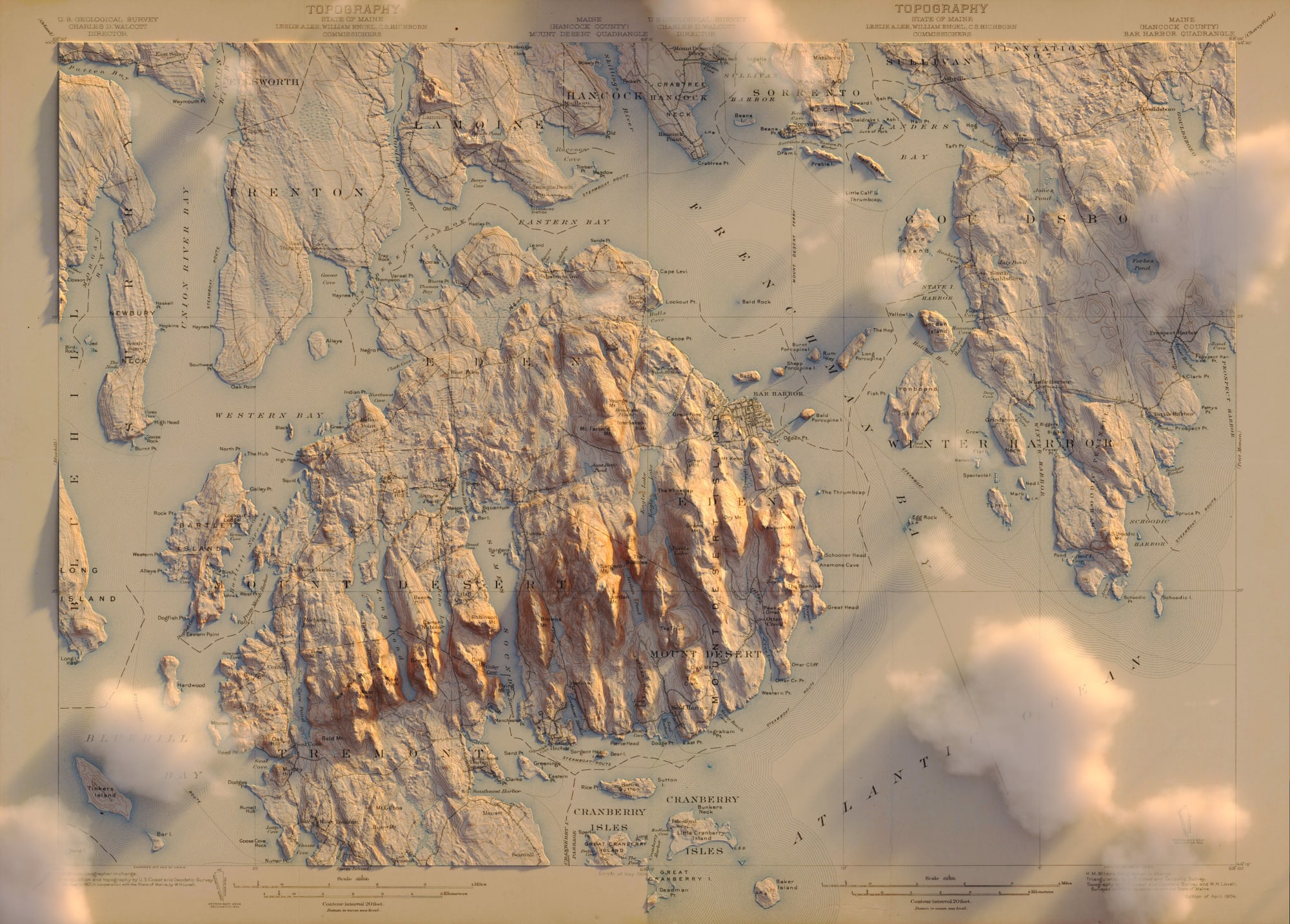
I totally lied when I said Yellowstone would be the last old render I revisit to add clouds.
— Sean Conway (@geo_spatialist) March 6, 2020
USGS Topo - 1904 Bar Harbor, ME and 1904 Mount Desert, ME - Two separate quads composited together. #arcgispro #blender #usgs #noaa (for the surface) #acadia pic.twitter.com/1GaUKCEZU9